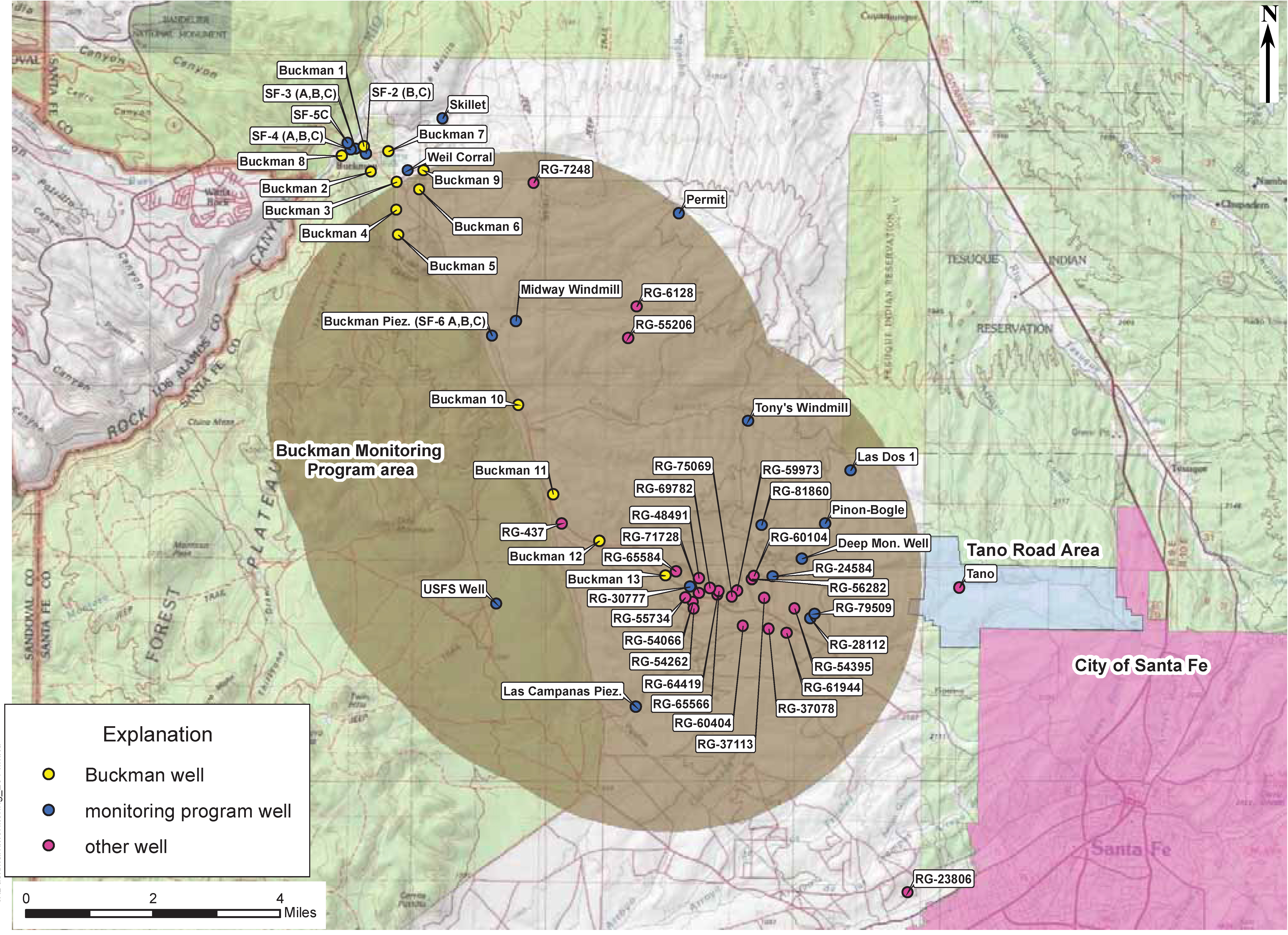
As part of the permit requirement for the Buckman Well Field (OSE permit RG-20516), the City of Santa Fe is required to conduct groundwater monitoring in the vicinity of the Buckman Well Field to help determine the incremental effects that pumping Buckman Well 10-13 will have on senior well in the area. To facilitate public understanding of the groundwater effects, all documents related to the use and monitoring of the Buckman wells will be made available through this webpage.

Buckman Wells Water Level Monitoring Network Map
- Buckman Regional Water Levels (Excel Spreadsheet) with monthly (Dating back to 1981) and daily (dating back to January 2006) production data, production well water level data, monitoring well data to present, and water level hydrographs.
- The Buckman Well 10-13 Water Level Monitoring Program (PDF) requirements document identifies the program's purpose and elements.
- Several monitoring wells in the Buckman well field area are measured periodically through a US Geological Survey/City Joint Funding Agreement. User-friendly data and hydrographs for most of these wells can be accessed at a USGS groundwater site for New Mexico. The GS well identification numbers and the water level information available to date have been downloaded and analyzed from the USGS Monitoring Well Data in the Buckman area within a Microsoft Excel spreadsheet.
Buckman Area Groundwater Monitoring Reports
The City's Biennial Monitoring Program Reports summarize the impacts of the pumping of Buckman Wells 10-13 on the groundwater and wells in the nearby area:
- 2024 Monitoring Program Report
- 2022 Monitoring Program Report
- 2020 Monitoring Program Report
- 2018 Monitoring Program Report
- 2016 Monitoring Program Report
- 2014 Monitoring Program Report
- 2012 Monitoring Program Report
- 2011 Monitoring Program Report
- 2009 Monitoring Program Report
Buckman Area Well Survey
As of February 2009, the City has completed a final well survey of all the wells in the monitoring program area. To increase the accuracy of the well information, the City has collected well information from well owners and neighborhood associations in the area.
